Journal of Charles Mason and Jeremiah Dixon
11/15/1763 - 9/11/1768
Add to Favorites:
Add all page(s) of this document to activity:


Add only page 1 to activity:
Add only page 2 to activity:
Add only page 3 to activity:
Add only page 4 to activity:
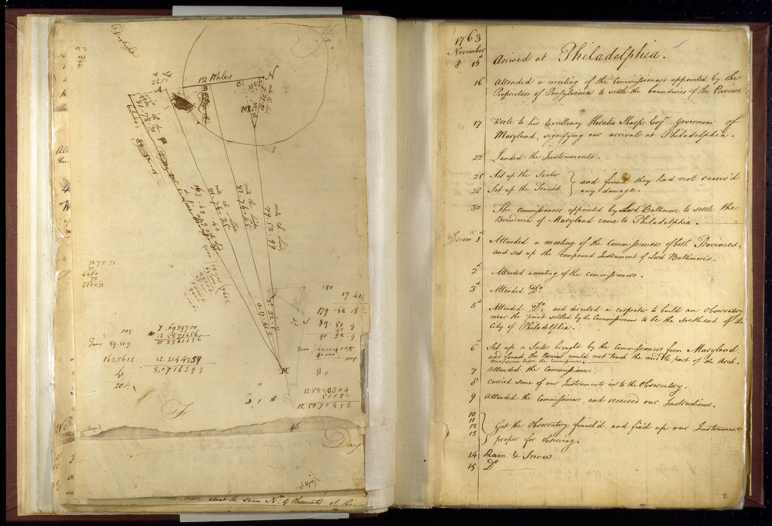
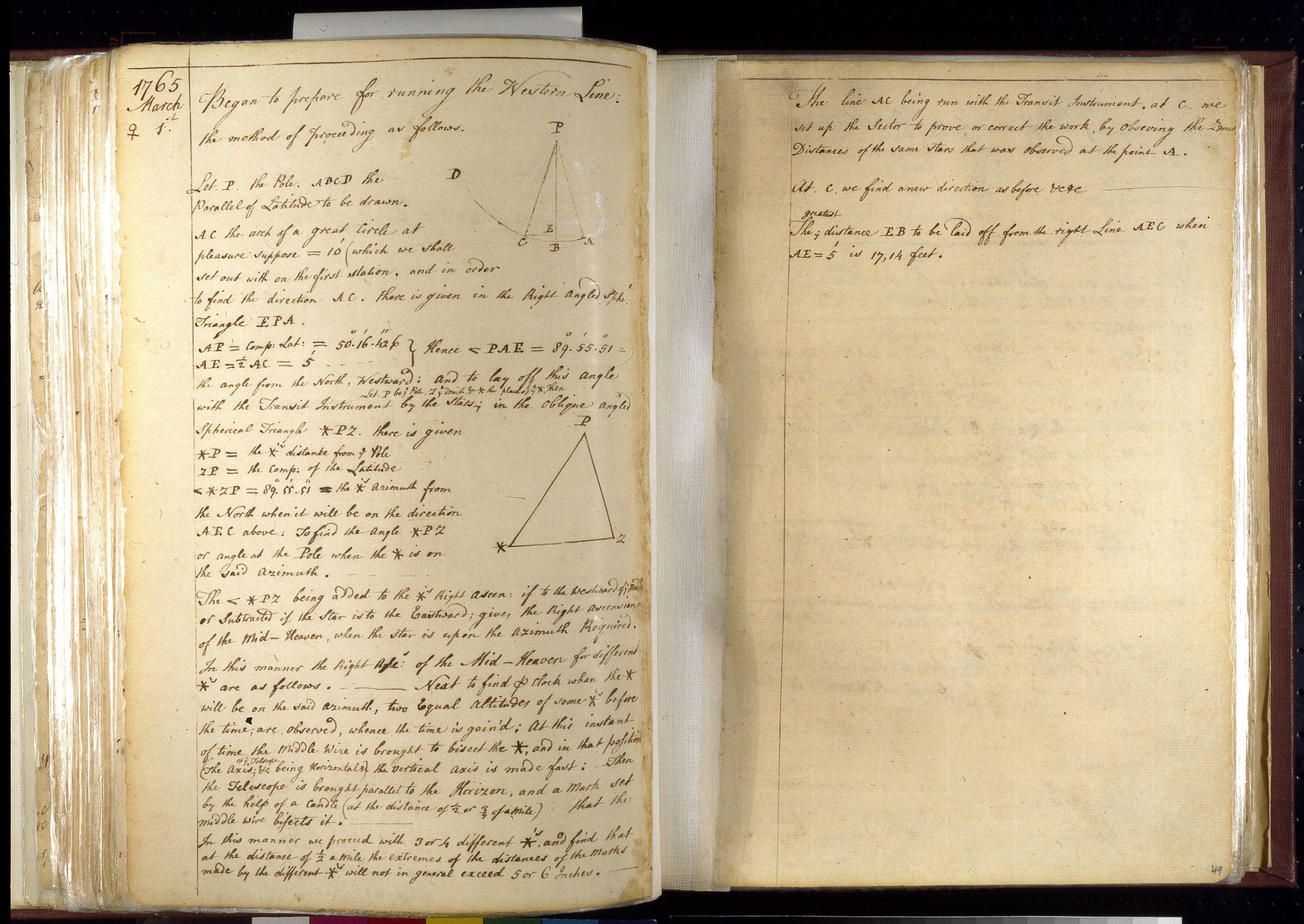
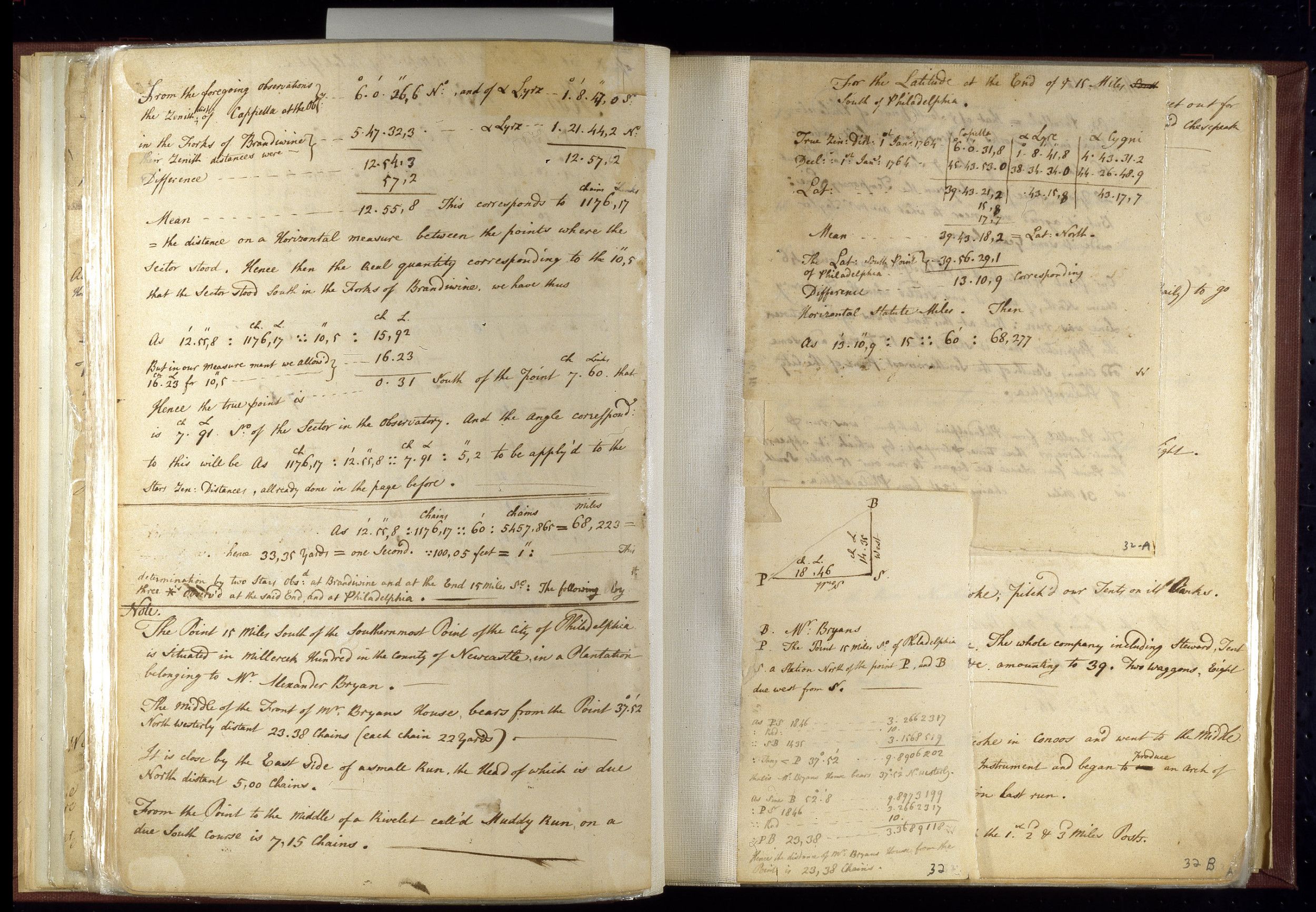
Charles Mason maintained field notes throughout the nearly 5 years it took to complete his survey. The journal includes mathematical and astronomical data, as well as the daily progress of the survey. Prior to hiring Mason and Dixon to settle a boundary line once and for all, the quarreling parties of Maryland and Pennsylvania agreed that the line separating the two provinces would be run east to west along a latitudinal arc 15 miles south of Philadelphia. The entry for June 12, 1764, reveals how Mason and Dixon located the starting point of the line that would later bear their name. Based on their calculations, the point 15 miles south of the southernmost point of Philadelphia was in a field belonging to Alexander Bryan.
This primary source comes from the General Records of the Department of State.
National Archives Identifier: 5821514
Full Citation: Journal of Charles Mason and Jeremiah Dixon; 11/15/1763 - 9/11/1768; General Records of the Department of State, Record Group 59. [Online Version, https://www.docsteach.org/documents/document/2-journal-of-charles-mason-and-jeremiah-dixon, April 26, 2024]Rights: Public Domain, Free of Known Copyright Restrictions. Learn more on our privacy and legal page.