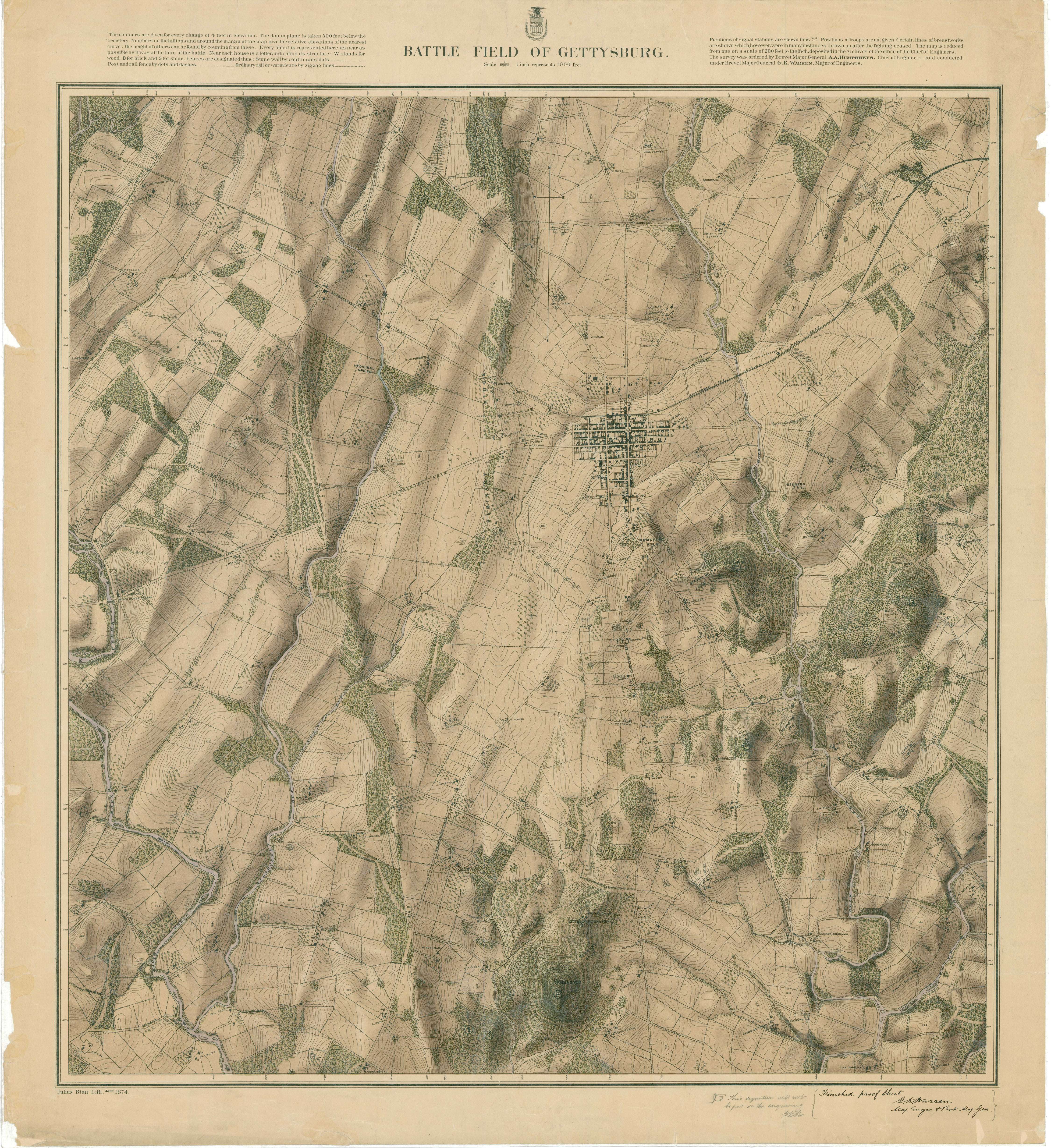
Final Proof of “Battle Field of Gettysburg” Map
1868-1873
Add to Favorites:
Add all page(s) of this document to activity:

A large-scale map of the Gettysburg battlefield was created under the direction of Gouverneur K. Warren, a noted engineer who had been present at the Battle of Gettysburg. The survey was made during the fall of 1868 and the summer and fall of 1869, and the map was revised on the ground by Civil Engineer P. M. Blake in May and June 1873.
This is one of the reduced scale versions of the map that were made. This particular copy is annotated as a “Final Proof” by Warren himself. Additionally, an annotation in pencil, also by Warren, appears next to the Final Proof marking, written to ensure that his signature was not included on the final printing of the map.
This is one of the reduced scale versions of the map that were made. This particular copy is annotated as a “Final Proof” by Warren himself. Additionally, an annotation in pencil, also by Warren, appears next to the Final Proof marking, written to ensure that his signature was not included on the final printing of the map.
This primary source comes from the Records of the Office of the Chief of Engineers.
Full Citation: Map 77-CWMF-E105-4; Final Proof of 'Battle Field of Gettysburg' Map; 1868-1873; Pennsylvania, Delaware, and the Delaware River; Civil Works Map File, 1818 - 1947; Records of the Office of the Chief of Engineers, Record Group 77; National Archives at College Park, College Park, MD. [Online Version, https://www.docsteach.org/documents/document/battle-field-gettysburg, April 25, 2024]Rights: Public Domain, Free of Known Copyright Restrictions. Learn more on our privacy and legal page.


