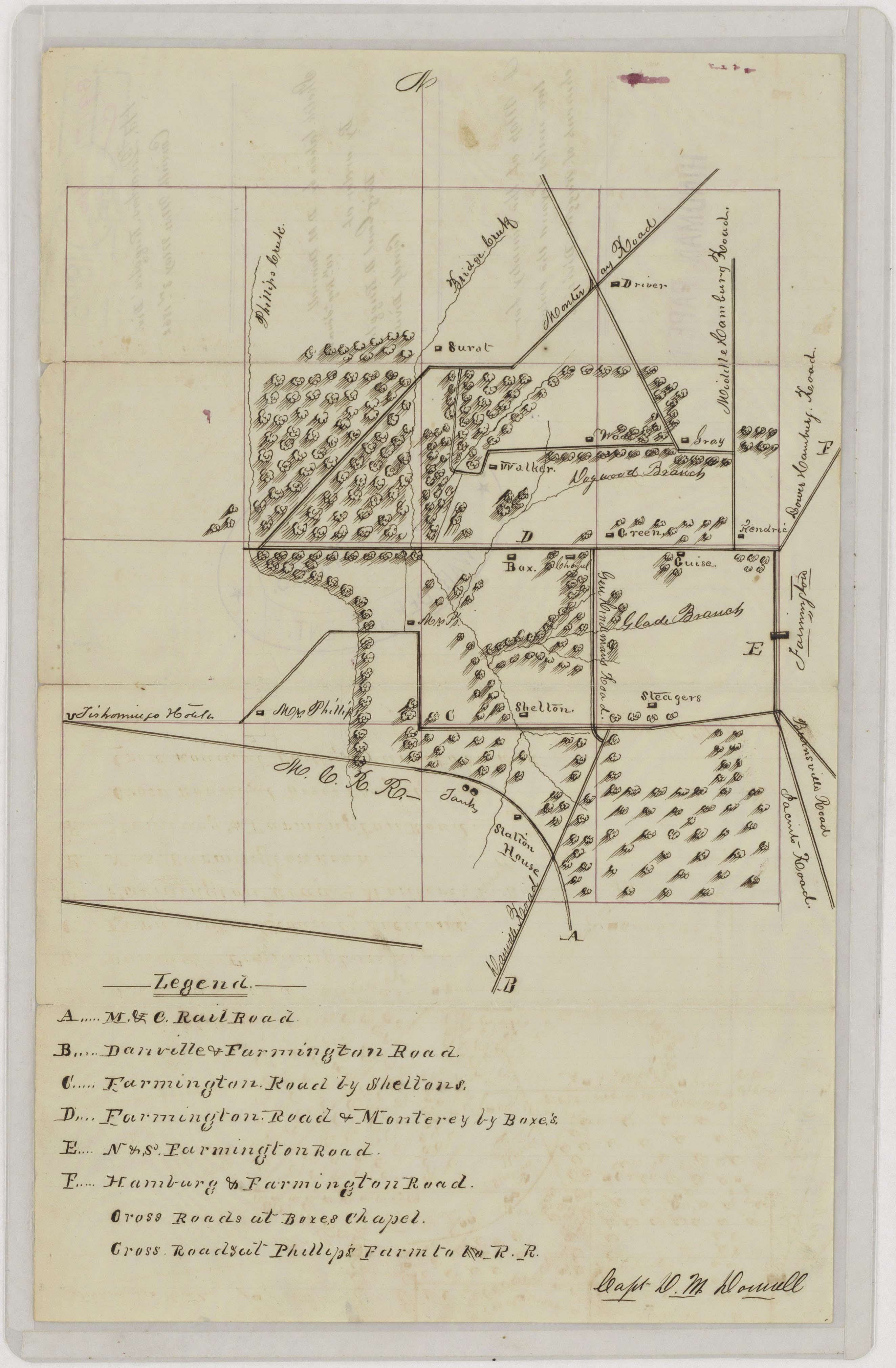
Sketch of the Vicinity of Corinth, Mississippi
1862
Add to Favorites:
Add all page(s) of this document to activity:

Add only page 1 to activity:
Add only page 2 to activity:
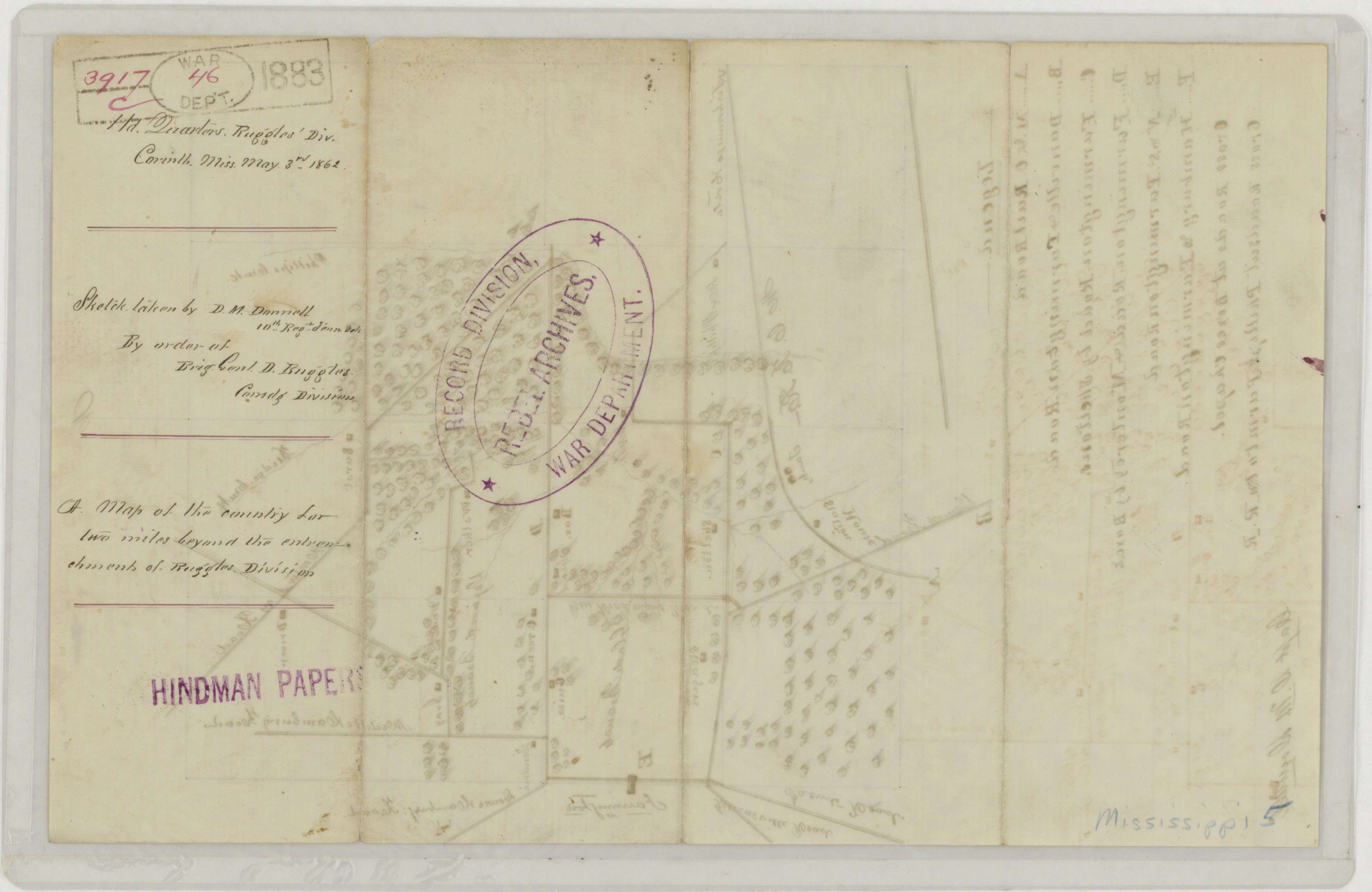
This map shows roads, rivers, vegetation, and residents near Corinth, Mississippi. It was drawn by D. M. Donnell of the 10th Regiment of Tennessee Volunteers by the order of Brig. General Daniel Ruggles to show "the country for two miles beyond the entrenchment of Ruggles' Division."
It is one of several maps created by the Confederate States of America that were acquired by the U.S. War Department by capture or surrender during the Civil War, or by donation or purchase after the War.
It is one of several maps created by the Confederate States of America that were acquired by the U.S. War Department by capture or surrender during the Civil War, or by donation or purchase after the War.
This primary source comes from the War Department Collection of Confederate Records.
National Archives Identifier: 70652997
Full Citation: Map MS-5; Sketch of the Vicinity of Corinth, Mississippi by Order of Brig. General D. Ruggles; 1862; Mississippi; Confederate Maps, 1861 - 1876; War Department Collection of Confederate Records, Record Group 109; National Archives at College Park, College Park, MD. [Online Version, https://www.docsteach.org/documents/document/corinth-mississippi, April 29, 2024]Rights: Public Domain, Free of Known Copyright Restrictions. Learn more on our privacy and legal page.