Map of Italy from the Moll Atlas
1709 - 1720
Add to Favorites:
Add all page(s) of this document to activity:
Herman Moll began work on "The World Described or, A New and Correct Sett of Maps" in 1707 and continued to work until it was completed in 1717. Originally published as a folio edition, this series took into account all of the known parts of the globe.
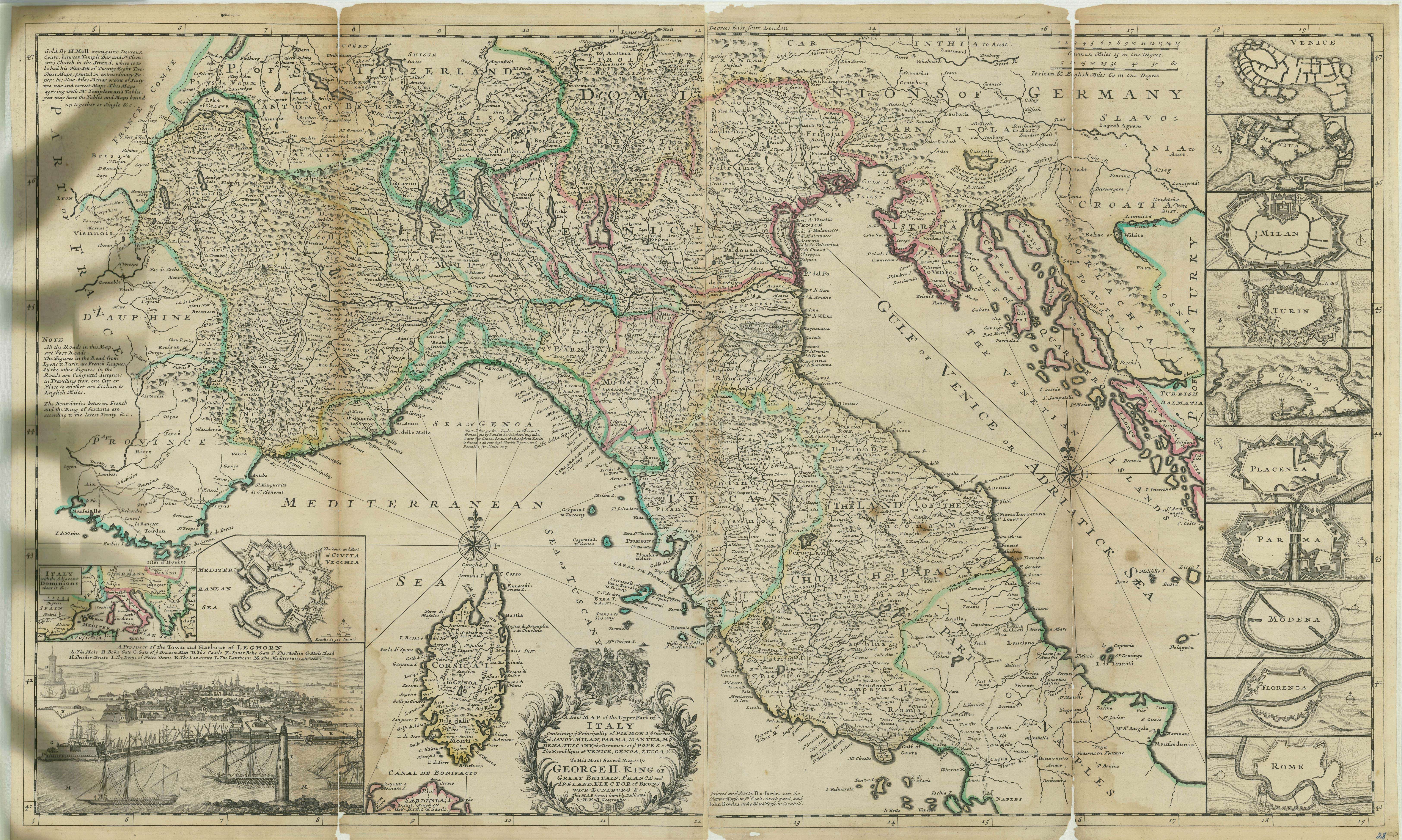
This map of Italy with engravings showing fortifications around several cities, listed as Plate XXVIII in the Atlas index, is described as:
This map of Italy with engravings showing fortifications around several cities, listed as Plate XXVIII in the Atlas index, is described as:
The Upper Part of Italy; containing the Principality of Piedmont, the Dutchies of Savoy, Milan, Parma, Mantua, Modena, Tuscany; the Dominions of the Pope, the Republics of Venice, Genoa, Lucca, &c. Dedicated to his Majesty King George II. This Map is ornamented with a Prospect of Leghorn. The Plains of the Fortifications of Rome, Florenza, Parma, Placenza, Genoa, Turin, Milan, Cevitta Vecchia, & c.
This primary source comes from the Records of Boundary and Claims Commissions and Arbitrations, 1716 - 1994.
National Archives Identifier: 76034896
Full Citation: Moll Atlas; 1709 - 1720; Maps and Related Records Pertaining to the Northeastern Boundary of the United States, ca. 1908 - ca. 1934; Records of Boundary and Claims Commissions and Arbitrations, 1716 - 1994, Record Group 76; National Archives at College Park, College Park, MD. [Online Version, https://www.docsteach.org/documents/document/italy-moll-atlas, April 19, 2024]Rights: Public Domain, Free of Known Copyright Restrictions. Learn more on our privacy and legal page.
