Map of North America from the Moll Atlas
1709 - 1720
Add to Favorites:
Add all page(s) of this document to activity:
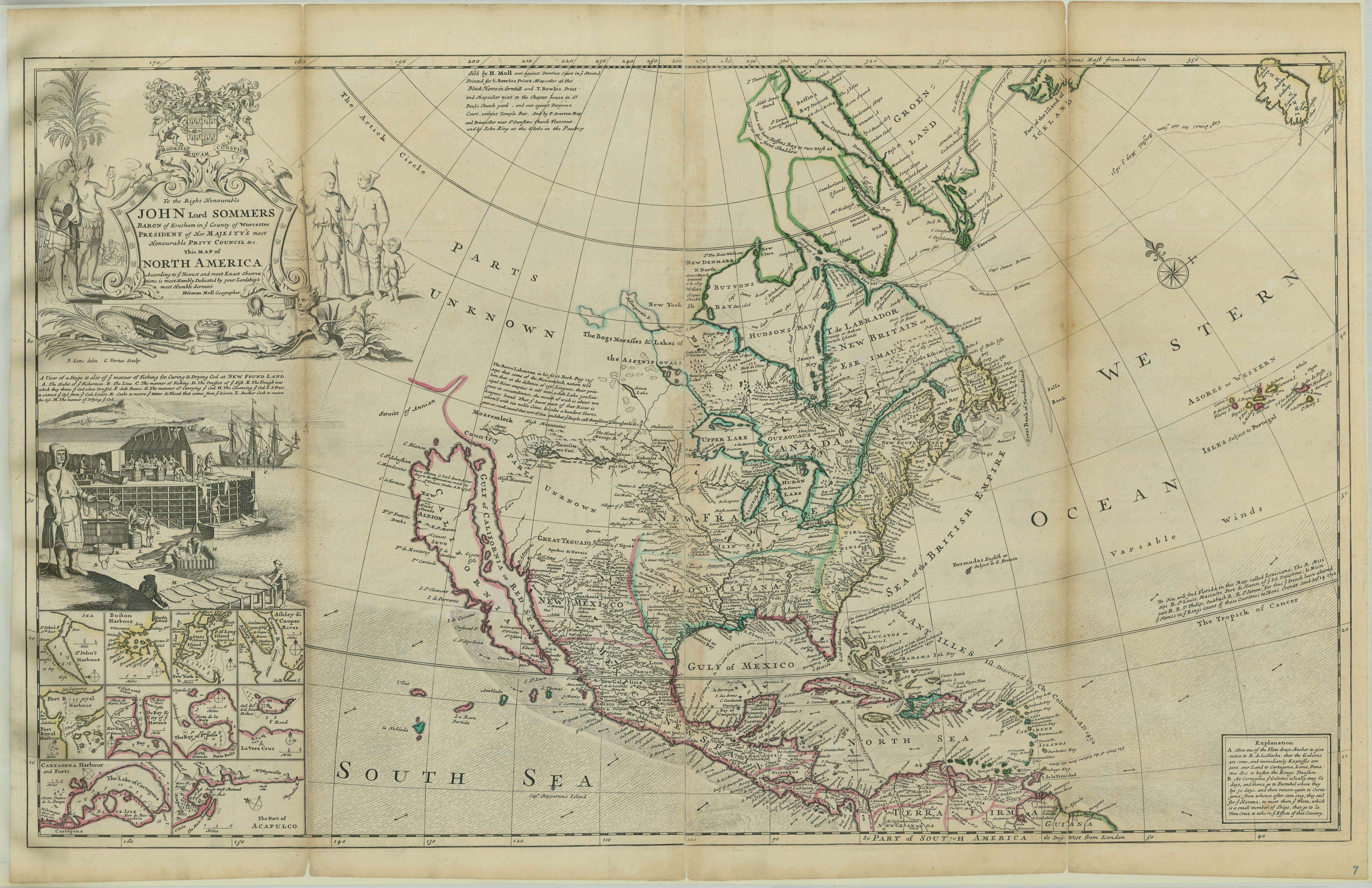
Herman Moll began work on “The World Described or, A New and Correct Sett of Maps” in 1707 and continued to work until it was completed in 1717. Originally published as a folio edition, this series took into account all of the known parts of the globe.
This map, Plate VII, is described in the Atlas's Index as:
This map, Plate VII, is described in the Atlas's Index as:
NORTH-AMERICA, with the Harbours of Boston, St. John, Port Royal, Cathagena, &c. and Capt. James's and Captain Hudson's Tract of Sailing from Great Birtain to this Part of the World, in search of new Discoveries; also a View of the Stage, and the manner of fishing for, curing, and drying Cod at Newfoundland.
This primary source comes from the Records of Boundary and Claims Commissions and Arbitrations, 1716 - 1994.
National Archives Identifier: 76034896
Full Citation: Map of North America from Moll Atlas; 1709 - 1720; Maps and Related Records Pertaining to the Northeastern Boundary of the United States, ca. 1908 - ca. 1934; Records of Boundary and Claims Commissions and Arbitrations, 1716 - 1994, Record Group 76; National Archives at College Park, College Park, MD. [Online Version, https://www.docsteach.org/documents/document/map-north-america-1712, April 18, 2024]Rights: Public Domain, Free of Known Copyright Restrictions. Learn more on our privacy and legal page.