Map of Missile Range in Cuba
1962
Add to Favorites:
Add all page(s) of this document to activity:
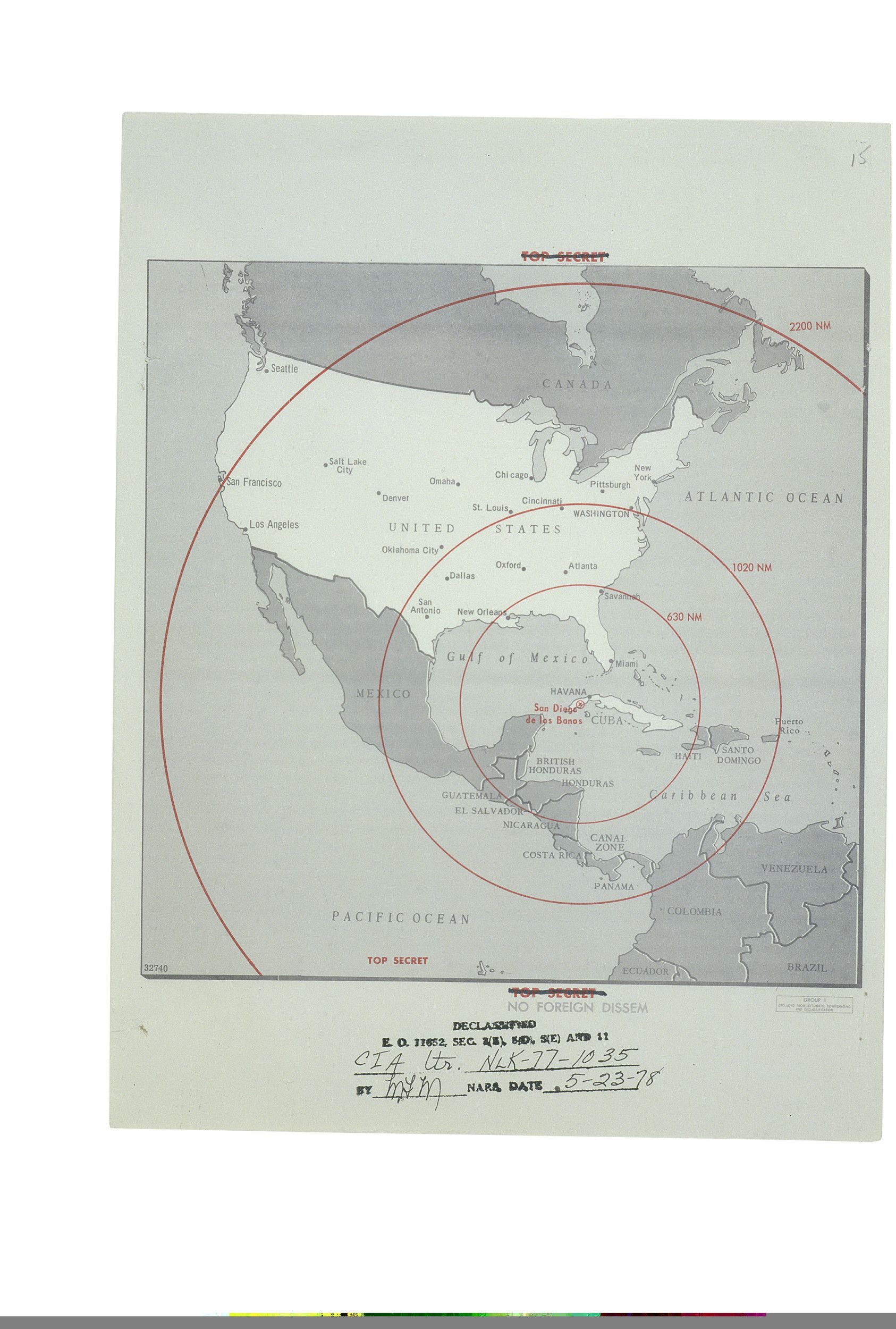
This map was used in President John F. Kennedy's Cuban Missile Crisis meetings, standing committee, September 1962 to October 1962 to show location in Cuba of potential missile range.
Additional details from our exhibits and publications
President John F. Kennedy used this map during Cuban Missile Crisis meetings from September 1962 to October 1962 to show the location in Cuba of a potential missile range.
This primary source comes from the Theodore Sorensen Papers.
National Archives Identifier: 595351
Full Citation: Map of Missile Range in Cuba; 1962; Theodore Sorensen Papers. [Online Version, https://www.docsteach.org/documents/document/map-of-missile-range-in-cuba, April 25, 2024]Rights: Public Domain, Free of Known Copyright Restrictions. Learn more on our privacy and legal page.
