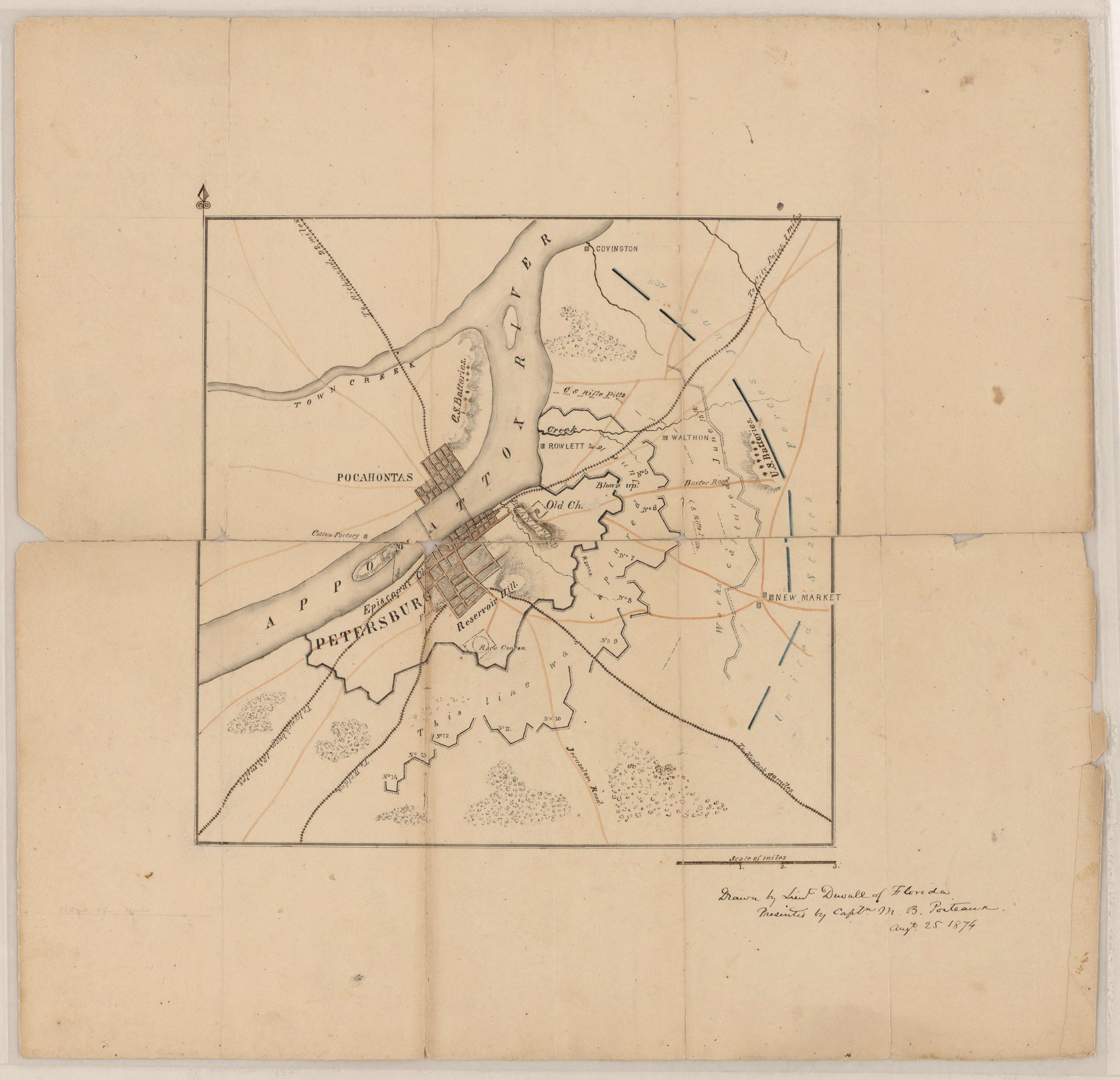
Sketch of Petersburg, Virginia Showing Its Defenses
ca. 1862
Add to Favorites:
Add all page(s) of this document to activity:


Add only page 1 to activity:
Add only page 2 to activity:
This Confederate map shows river, vegetation, topography, towns, roads, railroads, fortifications, and troop positions. It is one of several maps created by the Confederate States of America that were acquired by the U.S. War Department by capture or surrender during the Civil War, or by donation or purchase after the War. A note on the map says it was drawn by Lieut. Duvall of Florida and presented by Capt. M. B. Porteaux on August 25, 1874.
This primary source comes from the War Department Collection of Confederate Records.
National Archives Identifier: 70653207
Full Citation: Map VA-19; Sketch of Petersburg, Virginia Showing Its Defenses; ca. 1862; Virginia; Confederate Maps, 1861 - 1876; War Department Collection of Confederate Records, Record Group 109; National Archives at College Park, College Park, MD. [Online Version, https://www.docsteach.org/documents/document/petersburg-defenses, May 2, 2024]Rights: Public Domain, Free of Known Copyright Restrictions. Learn more on our privacy and legal page.