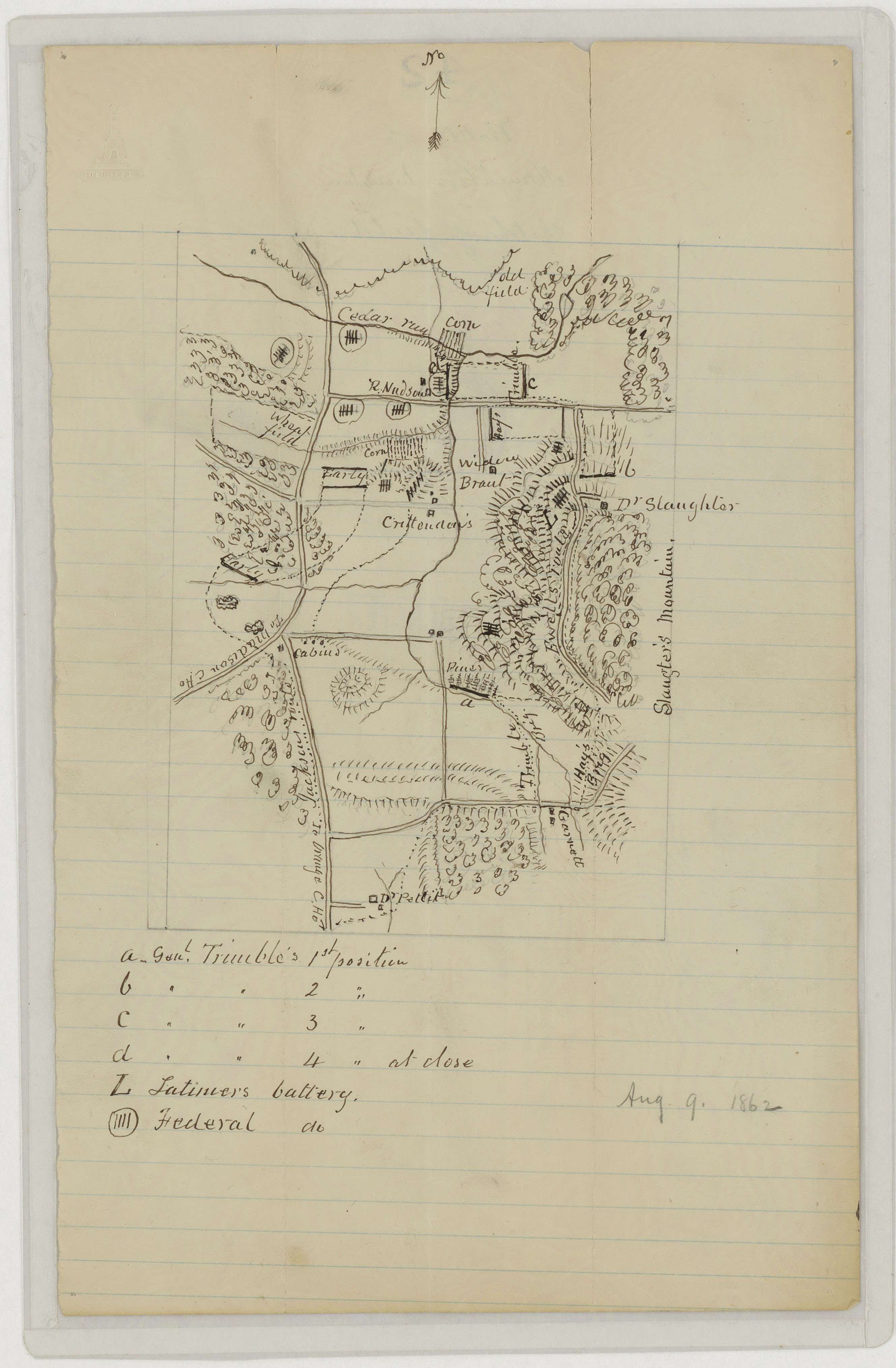
Sketch of the Slaughter's Mountain Battlefield
8/9/1862
Add to Favorites:
Add all page(s) of this document to activity:

Add only page 1 to activity:
Add only page 2 to activity:
This Confederate map shows topography, vegetation, rivers, roads, troop positions, and some residents. It is one of several maps created by the Confederate States of America that were acquired by the U.S. War Department by capture or surrender during the Civil War, or by donation or purchase after the War.
This primary source comes from the War Department Collection of Confederate Records.
National Archives Identifier: 70653187
Full Citation: Map VA-12; Sketch of the Slaughter's Mountain Battlefield, Virginia; 8/9/1862; Virginia; Confederate Maps, 1861 - 1876; War Department Collection of Confederate Records, Record Group 109; National Archives at College Park, College Park, MD. [Online Version, https://www.docsteach.org/documents/document/slaughters-mountain, May 8, 2024]Rights: Public Domain, Free of Known Copyright Restrictions. Learn more on our privacy and legal page.