Survey Map of the Oklahoma and Indian Territory showing Distances, Municipal Towns and Post Offices, published by George Cram
3/16/1905
Add to Favorites:
Add all page(s) of this document to activity:
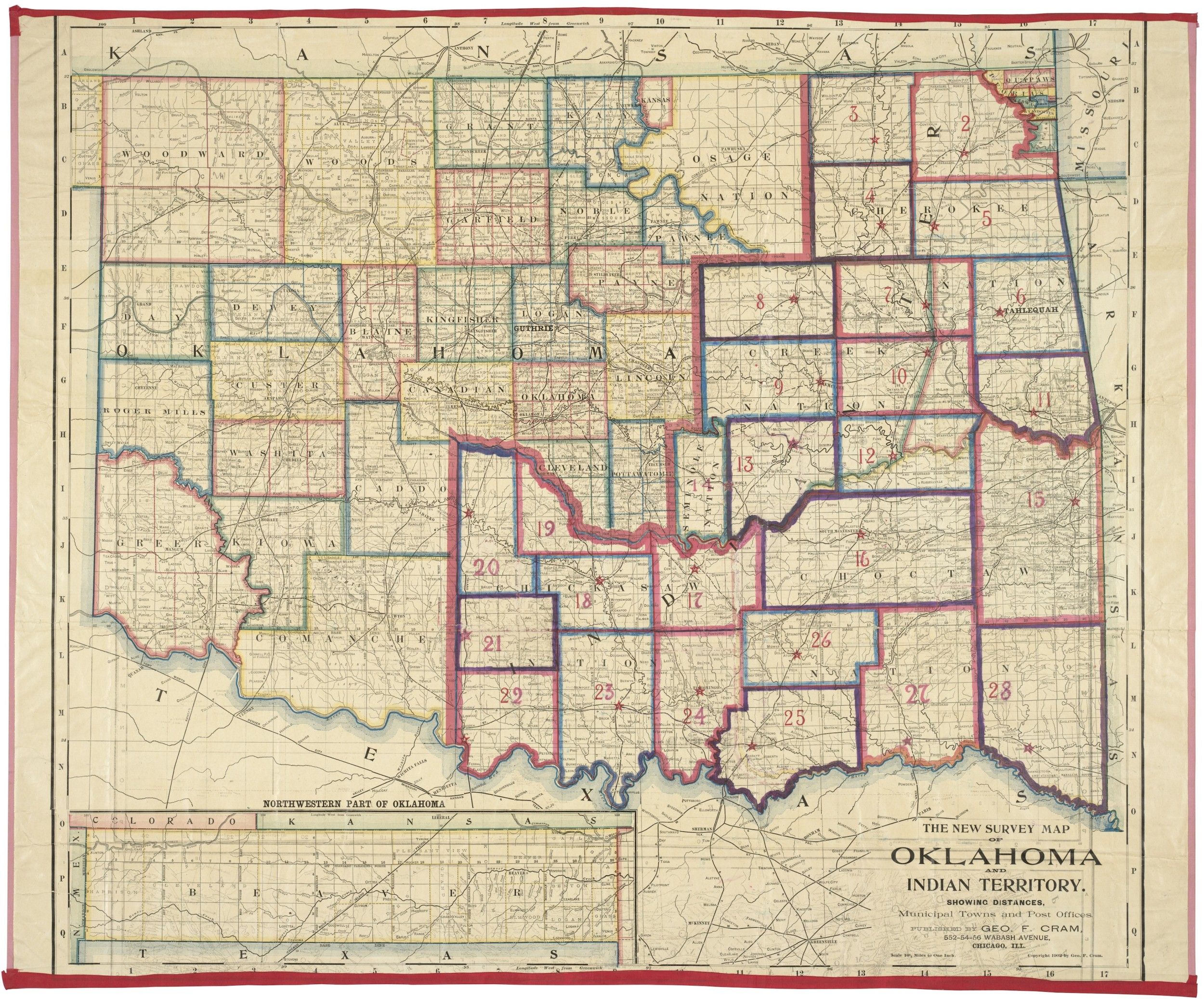
Most of the land that is now Oklahoma was acquired by the United States in 1803 as part of the Louisiana Purchase. In the 1830s, the United States used the land to relocate Indian tribes and the Indian Territory was formed from the land set aside by the Indian Intercourse Act of 1834. The Indian Territory originally extended beyond present-day Oklahoma, but the size was gradually reduced over the course of the 19th century. In 1889 the Congress authorized the opening land seized from the Indian Territory for homestead settlement, and a year later Congress passed an act that officially created the Oklahoma Territory.
This primary source comes from the Records of the U.S. House of Representatives.
National Archives Identifier: 7260790
Full Citation: Survey Map of the Oklahoma and Indian Territory showing Distances, Municipal Towns and Post Offices, published by George Cram; 3/16/1905; Records of the U.S. House of Representatives, Record Group 233. [Online Version, https://www.docsteach.org/documents/document/survey-map-of-the-oklahoma-and-indian-territory-showing-distances-municipal-towns-and-post-offices-published-by-george-cram, April 19, 2024]Rights: Public Domain, Free of Known Copyright Restrictions. Learn more on our privacy and legal page.
