A Topographical Map of the Northn. Part of New York Island
3/1/1777
Add to Favorites:
Add all page(s) of this document to activity:
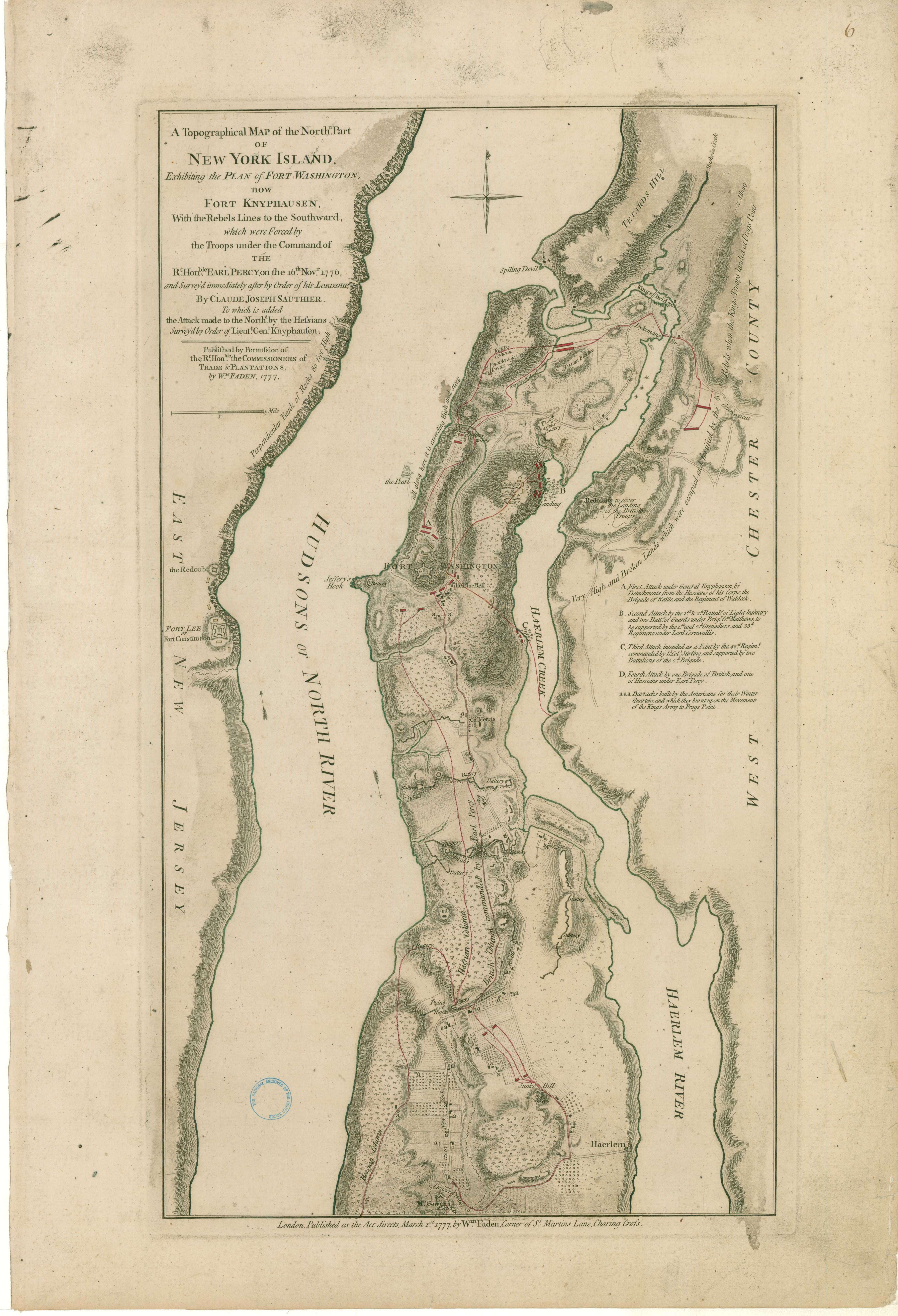
Atlas of Battles of the American Revolution, Sheet 6: A Topographical Map of the Northn. Part of New York Island, Exhibiting the Plan of Fort Washington, now Fort Knyphausen, With the Rebels Lines to the Southward, which were Forced by the Troops under the Command of the Rt. Honble. Earl Percy, on the 16th. Novr. 1776, and Survey'd immediately after by Order of his Lordship
This primary source comes from the Records of the Office of the Chief of Engineers.
National Archives Identifier: 102279692
Full Citation: A Topographical Map of the Northn. Part of New York Island; 3/1/1777; Civil Works Map File, 1818 - 1947; Records of the Office of the Chief of Engineers, Record Group 77; National Archives at College Park, College Park, MD. [Online Version, https://www.docsteach.org/documents/document/topographical-map-new-york-island, April 23, 2024]Rights: Public Domain, Free of Known Copyright Restrictions. Learn more on our privacy and legal page.
