The Chilean Question
1843 - 1876
Add to Favorites:
Add all page(s) of this document to activity:
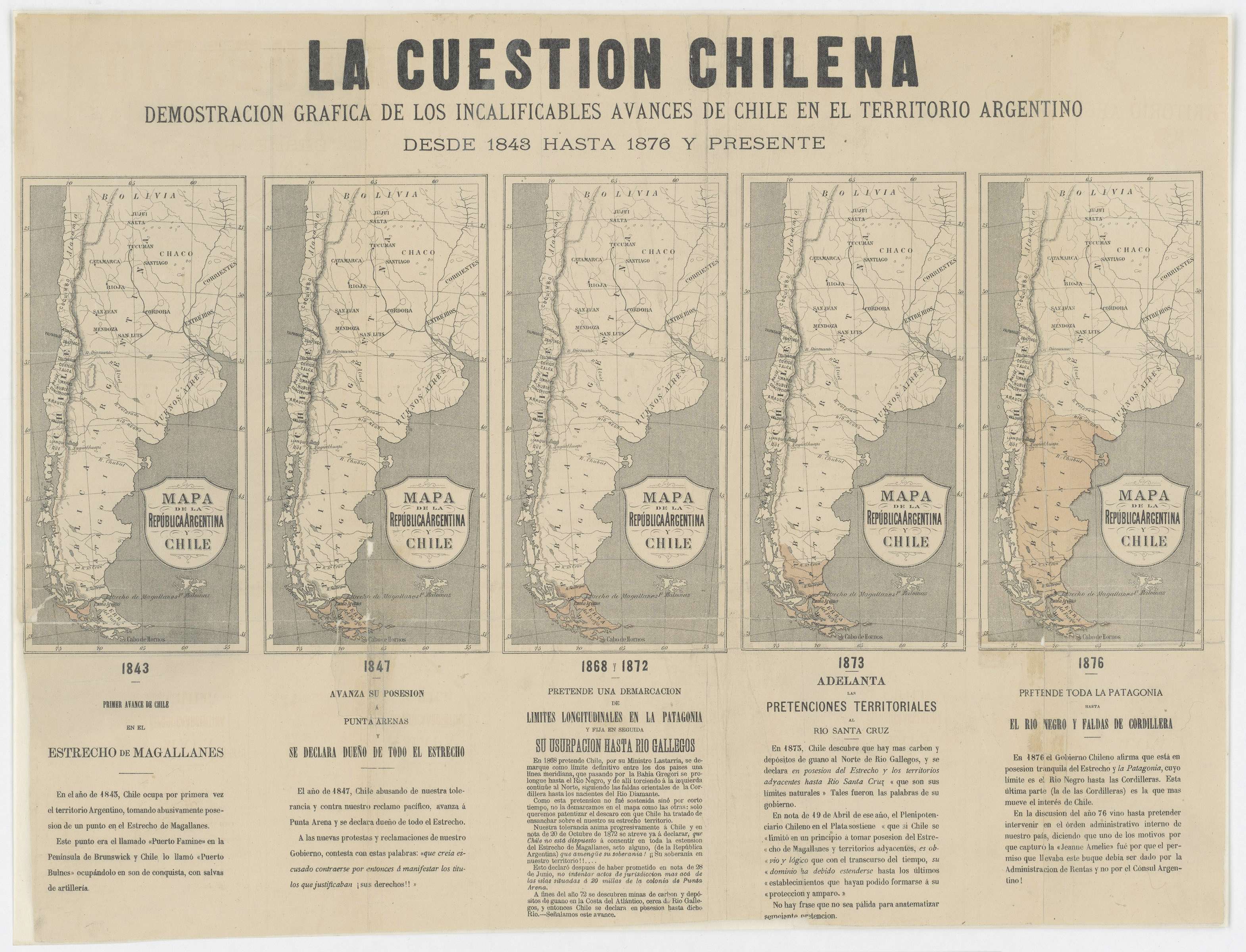
This map was sent to United States Secretary of State William M. Evarts from United States Minister to Argentina Thomas Ogden Osborn. The map, provided to Osborn by the Argentine Minister of Foreign Affairs, graphically displays what Argentina considered the ongoing encroachment upon Argentine territory in the Patagonia region of South America by Chile.
Map notations are written in Spanish.
Map notations are written in Spanish.
This primary source comes from the General Records of the Department of State.
National Archives Identifier: 5675669
Full Citation: La Cuestion Chilena - Demostracion Grafica de los Incalificables Avances de Chile en el Territorio Argentino; 1843 - 1876; Despatches from U.S. Ministers to Argentina; Despatches from Diplomatic Officers, 1789 - 1906; General Records of the Department of State, Record Group 59; National Archives at College Park, College Park, MD. [Online Version, https://www.docsteach.org/documents/document/the-chilean-question, May 9, 2024]Rights: Public Domain, Free of Known Copyright Restrictions. Learn more on our privacy and legal page.
