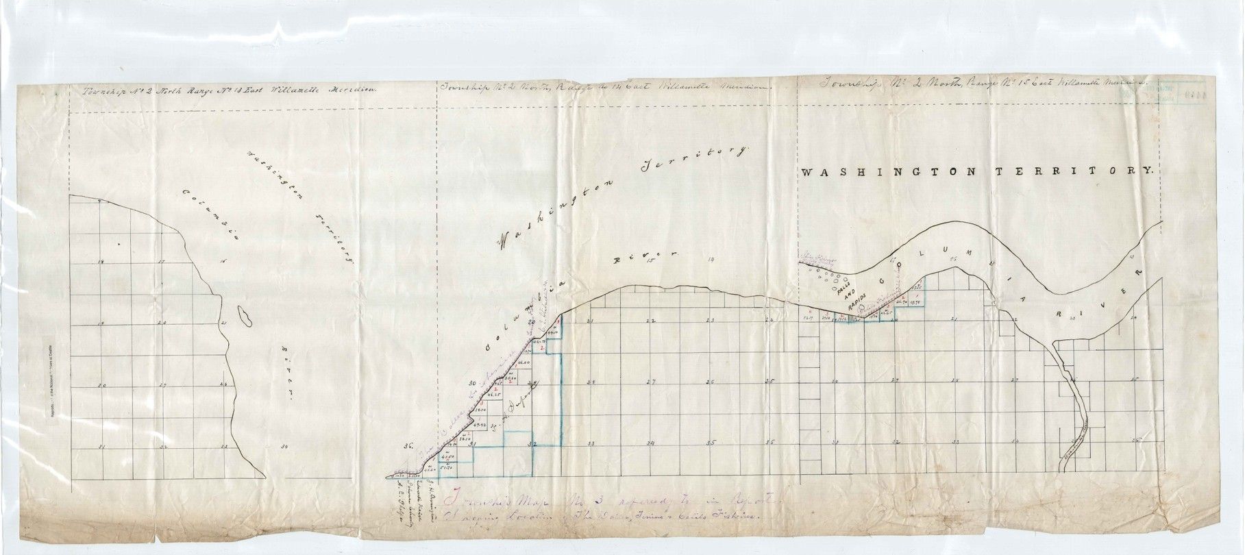
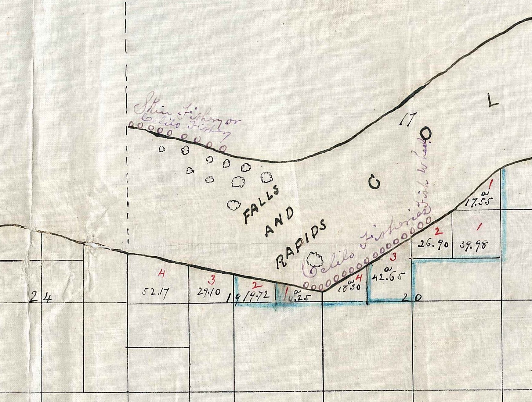
Township No 3 Showing Locations of the Dalles, Tenino and Celilo Fisheries
1/19/1889
Add to Favorites:
Add all page(s) of this document to activity:

Add only page 1 to activity:
Add only page 2 to activity:
This map, that accompanied a report by G. Gordon, shows a portion of the Columbia River indicating the locations of Celilo, Tenino and the Dalles Native fisheries. This document was digitized by teachers in our Primarily Teaching 2015 Summer Workshop in Seattle.
This primary source comes from the Records of the Bureau of Indian Affairs.
National Archives Identifier: 22440066
Full Citation: Township No 3 Showing Locations of the Dalles, Tenino and Celilo Fisheries; 1/19/1889; Maps from Reports of Agent Gordon, 1889; Report Upon the Subject of the Fishing Privileges Guaranteed by Treaties to Indians in the Northwest, 1/19/1889 - 1/19/1889; Records of the Bureau of Indian Affairs, Record Group 75; National Archives at Seattle, Seattle, WA. [Online Version, https://www.docsteach.org/documents/document/township-no-3-showing-locations-dalles-tenino-celilo-fisheries, April 29, 2024]Rights: Public Domain, Free of Known Copyright Restrictions. Learn more on our privacy and legal page.
